Amazon Bestseller
Beliebtesten Produkte, basierend auf Verkaufszahlen.
Finden Sie die besten Angebote unter den Amazon Bestsellern!
Jetzt Entdecken
Wird häufig aktualisiert
Curiosities Maps produkts aus dem ebay.co.uk #2
Diese Site enthält Affiliate-Links, für die ich möglicherweise eine Vergütung erhalte.
Diese Webseite/Seite enthält Affiliate-Links von eBay über das eBay Partner Network (EPN). Das bedeutet, dass wir möglicherweise eine Provision für Einkäufe erhalten, die über diese Links getätigt werden. Bitte beachten Sie, dass dies unsere Produktauswahl nicht beeinflusst und keine zusätzlichen Kosten für Sie verursacht. Wir bemühen uns stets, objektive und ehrliche Empfehlungen zu geben.
Diese Webseite/Seite enthält Affiliate-Links von eBay über das eBay Partner Network (EPN). Das bedeutet, dass wir möglicherweise eine Provision für Einkäufe erhalten, die über diese Links getätigt werden. Bitte beachten Sie, dass dies unsere Produktauswahl nicht beeinflusst und keine zusätzlichen Kosten für Sie verursacht. Wir bemühen uns stets, objektive und ehrliche Empfehlungen zu geben.
Alle Waren 2 300
 24.60 GBP ~ 29.15 EUR
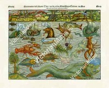
Antique chart SEA & LAND MONSTERS woodblock Munster 1544 wall art print poster
 56.28 GBP ~ 66.69 EUR
FRENCH MAP OF BICYCLE ROUTE Routier No. 94 St. Die to Gerardmer c.1910s CYCLING
 15.00 GBP ~ 17.78 EUR
F.A.BROCKHAUS 1905 " INDISCHER OCEAN " GERMAN ,MAP
 37.51 GBP ~ 44.45 EUR
1920s Antique Maps Catholic Church Mission China Hindustan Indochina British
 4.50 GBP ~ 5.33 EUR
Original Antique 1896 Map Of Dominion Of Canada
 39.00 GBP ~ 46.22 EUR
A 1910s 'Bartholomew's' Quarter Inch to the Mile Folding Map of Devon & Cornwall
 1.70 GBP ~ 2.01 EUR
Old Ordnance Survey Map the Godfrey Edition Halifax SE 1905
 39.00 GBP ~ 46.22 EUR
Genealogical Handbook English History JPA Long 1886 6th Ed Folding Chart
 10.80 GBP ~ 12.8 EUR
Original 1794 Archibald engraving of a view of Longford
 4.50 GBP ~ 5.33 EUR
Original Antique 1896 Map Of Egypt British Occupation Of Egypt
 4.50 GBP ~ 5.33 EUR
Original Antique 1896 Map Of West Africa Gold Coast
 4.50 GBP ~ 5.33 EUR
Original Antique 1896 Map Of Dominion Of Canada
 4.50 GBP ~ 5.33 EUR
Original Antique 1896 Map Of New South Wales Australia
 15.07 GBP ~ 17.86 EUR
Ordnance Survey Vintage 1912 Map Newcastle On Tyne, Sheet 7, 1 Inch/Mile.
 29.99 GBP ~ 35.54 EUR
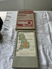
Vintage Auto Mapic Great Britain Mechanical Road Map Boxed 1950s 60s
 187.58 GBP ~ 222.29 EUR
125+ 1891-1895 Union & Confederate Armies Atlas MAPS, Colored, 29.5" x 18.5"
 4.50 GBP ~ 5.33 EUR
Original Antique 1896 Map Of Queensland British New Guinea Australia
 10.80 GBP ~ 12.8 EUR
Original 1794 Archibald Print of Sion Lodge
 4.50 GBP ~ 5.33 EUR
Original Antique 1896 Map Of Queensland Australia
 10.80 GBP ~ 12.8 EUR
Original 1794 Archibald Print View of the lodge in the green park
 4.50 GBP ~ 5.33 EUR
Original Antique 1896 Map Of Victoria New South Wales Australia
 55.00 GBP ~ 65.18 EUR
Auto Mapic Road Map of Great Britain 1950-60 With Leather Case Early Version
 58.00 GBP ~ 68.73 EUR
VINTAGE LARGE MAP of BRITAIN RAILWAYS PASSENGER TRAINS STATISTICS TRAFFIC
 19.35 GBP ~ 22.93 EUR
Vintage Auto-Mapic Great Britain Automatic Road Map Original Box - Automobilia
 37.10 GBP ~ 43.97 EUR
Vintage Antique Westmorland Kendal Framed Map
 8.99 GBP ~ 10.65 EUR
1950s Vintage Road Map By SHELL Oil Company of Victoria & New South Wales
 10.80 GBP ~ 12.8 EUR
Original 1794 Archibald Engraving of Benham House
 10.80 GBP ~ 12.8 EUR
1987 Shell oil Map of Sydney Australia vintage
 16.04 GBP ~ 19.01 EUR
Sea Chart river Tyne to flamborough headSee Photos
 16.04 GBP ~ 19.01 EUR
sea chart braich -y- pell to clogher head See Photos
 75.00 GBP ~ 88.88 EUR
Vintage Educational Map 'The Journeys of St Paul' - 1967
 16.04 GBP ~ 19.01 EUR
Sea Chart Of winterton Ness to orford Ness See Photos
 128.00 GBP ~ 151.69 EUR
1919 LARGE MAP ~ NEW ZEALAND SOUTH ISLAND CHRISTCHURCH CHATRAM STEWART
 6.50 GBP ~ 7.7 EUR
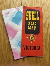
1956 Vintage Road Map By SHELL Oil Company of VICTORIA Australia Melbourne
 8.65 GBP ~ 10.25 EUR
Admiralty Chart of Port Victoria & Approaches, Indian Ocean. Printed 1969.
 128.00 GBP ~ 151.69 EUR
1919 LARGE MAP ~ NEW ZEALAND LAND HEIGHTS VEGETATION MEAN ANNUAL TEMPERATURE
 23.57 GBP ~ 27.93 EUR
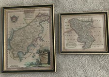
Pair Of Framed Antique Maps Derbyshire & Northamptonshire/ J. Seller
 234.70 GBP ~ 278.13 EUR
1903 W & A.K. Johnston's Map to Illustrate the Somaliland Question - Africa
 105.00 GBP ~ 124.43 EUR
Antique Engraving "Geometry" Richard Blome, 1710
 38.04 GBP ~ 45.08 EUR
three sea charts of the french coast See Photos
 20.00 GBP ~ 23.7 EUR
murray's classical map 1904 - roman empire
 16.15 GBP ~ 19.14 EUR
Map of Brighton - Bartholomew's Town Plan 1920/30s